How People Found Their Way Around Before Neighbourhood Maps
Discover how neighbours once shared directions through street names, landmarks and local meeting points, and how those customs still help people find places.
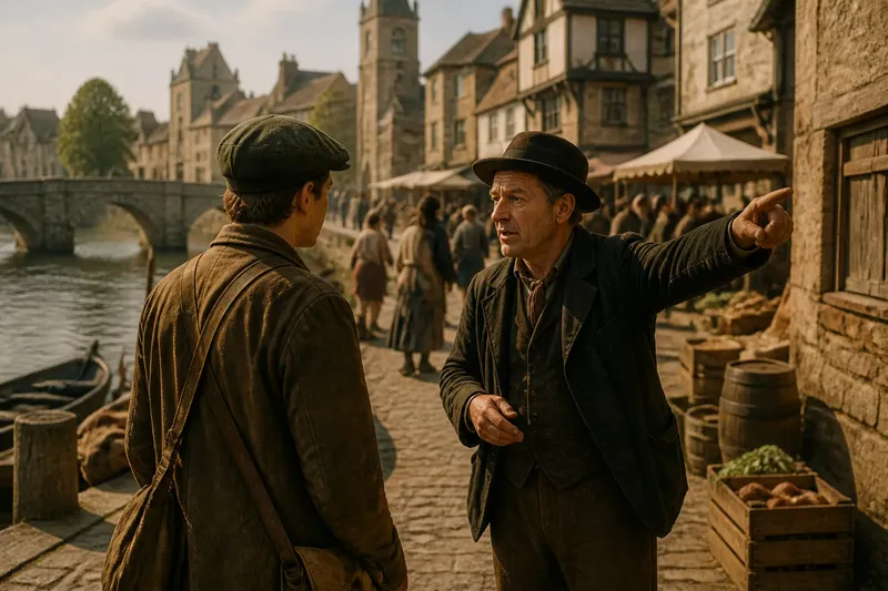
At the grocer’s counter, someone asks how to reach the old meeting hall. The answer comes as a chain of familiar places: past the pump, across the market square, then beside the chapel wall. Before neighbourhood maps were commonly available to everyone, directions like these could turn shared local knowledge into a practical route.
There was no single way people learned a place. Some followed a regular walk to work or market; others asked a neighbour, watched the flow of people or used signs and landmarks. The details varied by town and period, but oral directions and recognisable public features offered useful clues where a printed map was absent or unfamiliar.
Local directions relied on familiar places
A direction made sense when speaker and listener shared a reference point. “Turn after the fountain” was useful if both knew which fountain; a street name could be less helpful if the listener had never seen it written down. Markets, churches, bridges, inns, wells and civic buildings often served as meeting points because people knew where they stood in everyday life.
Local names could also carry a place’s history. A lane might still be called by the trade once practised there, or a corner by a building that had changed use. Such names were not always official or universally understood. A visitor might need to ask what the name referred to now, then match the answer to a visible feature.
Walking connected spoken instructions to the street
People could learn a route by making the journey with someone who knew it. The experienced walker might point out a turn, identify a landmark and explain what came next. On later trips, the learner could use those cues to recognise the way, while remaining alert to changed conditions or missed turns.
Routes were also learned through errands and repeated journeys. A person going to the market, a place of worship or a neighbour’s home could become familiar with the streets along the way. That familiarity did not require a complete mental picture of the neighbourhood; knowing a few connected routes might be enough for ordinary needs.
Landmarks and street names did different jobs
A landmark helped someone identify a spot on the ground: the stone bridge, the clock above a shop or the edge of a square. A street name could identify a route more precisely, particularly when signs displayed it at a junction. Used together, they made directions easier to check: follow the named road until the bridge, then turn beside the public house.
Neither kind of clue was foolproof. A sign might be missing, a business might close, or a landmark might look different from the opposite direction. Local directions worked best when they offered more than one cue and allowed the listener to ask for clarification.
What did people do when directions were unclear?
How did a traveller ask for the right road?
A traveller could give a known starting point and name the destination, then ask someone nearby for the route. If the answer depended on an unfamiliar local name, asking what building or feature stood there could make it more useful.
Could landmarks replace street signs?
Landmarks could help identify turns and destinations, but they did not always identify a street by name. A bridge or church might orient someone locally, while signs, spoken clarification or another landmark helped distinguish between nearby roads.
How did people remember a route after one walk?
One walk might leave a useful impression, but it would not ensure that a person remembered every turn. Repeating the journey, recounting its landmarks or asking for directions again could strengthen familiarity and correct a mistaken recollection.
How could someone explain a route to a stranger?
They could start from a place the stranger recognised, give turns in order and name visible cues along the way. A quick check—such as asking the listener to repeat the next turning—could reveal where the explanation needed more detail.
Shared routes made public places easier to reach
Markets, bridges, squares and places of worship were more than destinations. They could also serve as reference points in conversations about where streets led. A person who knew the route to a market might explain nearby lanes through the stalls or entrance, linking private errands to familiar public space.
Say a visitor in an invented historic town asks how to reach its guild hall, starting from the riverside landing. A local says to follow the river to the stone bridge, cross it, then ask at the market square for the hall’s side entrance. The visitor can check each stage against a visible place; if the market is busy and the entrance is hard to spot, asking again at the square supplies the next clue rather than pretending the first directions were complete.
Local knowledge changed as streets changed
Roads, buildings and names did not remain fixed. A new bridge could alter a familiar journey, while a closed inn might leave an old direction confusing. People could adapt by using a surviving feature, a new sign or a question to someone who knew the current layout.
That practical, social habit still matters in neighbourhoods where a map is unavailable, a street sign is obscured or a place is known locally by another name. The phrase “before the neighbourhood map” describes no universal moment when maps suddenly appeared; it points to a long-standing way of finding places through shared words, public landmarks and ordinary journeys. When giving directions today, adding one recognisable local reference beside the street name can make the route clearer to someone arriving for the first time.